Introduction
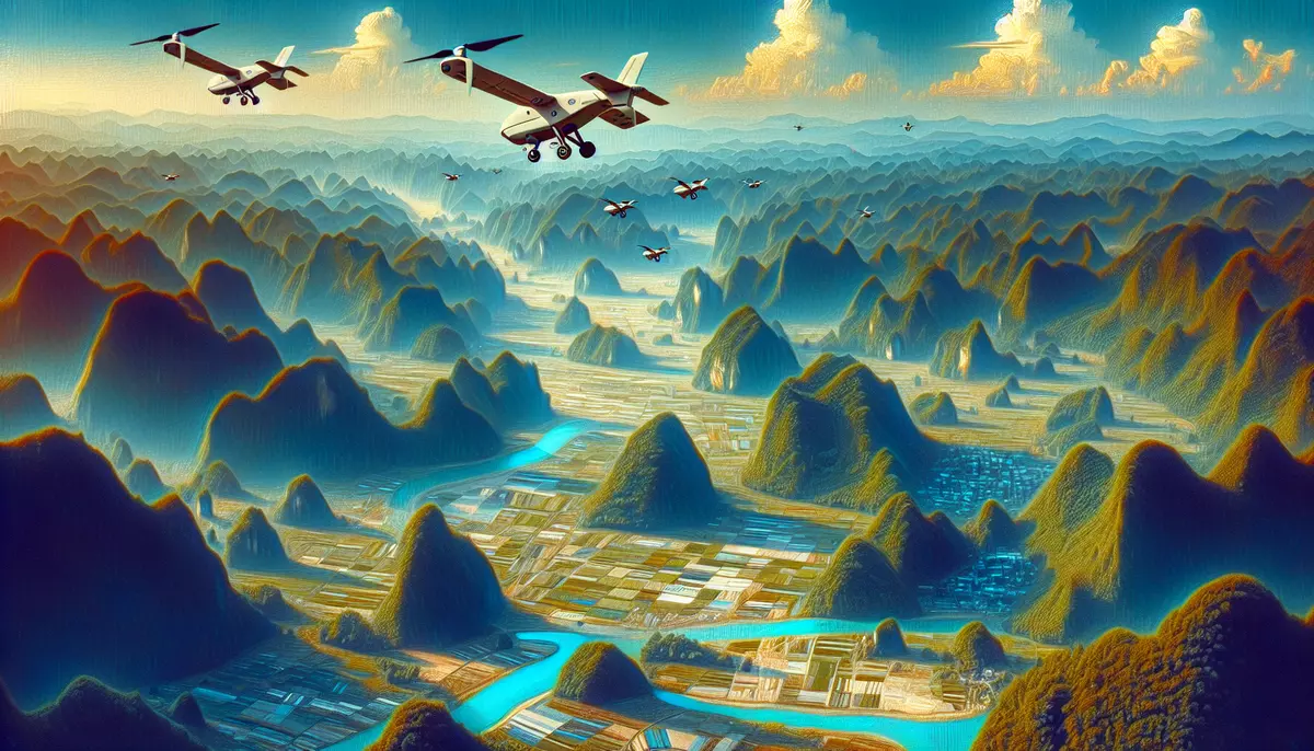
Unmanned Aerial Vehicles (UAVs), also known as drones, have revolutionized the field of mapping and surveying. These aerial platforms equipped with advanced sensors and cameras provide a cost-effective and efficient means of capturing high-resolution spatial data, enabling a wide range of applications in fields such as urban planning, environmental monitoring, and infrastructure management.
What is UAV Mapping and Surveying?
UAV mapping and surveying refers to the use of unmanned aerial vehicles to collect geospatial data, including aerial imagery, topographic information, and other spatial data. These data can be processed and analyzed to create detailed maps, 3D models, and other spatial products that support various decision-making processes.
Key Characteristics of UAV Mapping and Surveying:
- High-Resolution Imagery: UAVs can capture high-resolution aerial photographs and videos, providing detailed information about the surveyed area.
- Flexibility and Accessibility: UAVs can access areas that are difficult or dangerous for traditional survey methods, such as mountainous terrain or urban environments.
- Cost-Effectiveness: UAV-based mapping and surveying are generally more cost-effective compared to traditional methods, such as manned aircraft or satellite imagery.
- Rapid Data Acquisition: UAVs can quickly and efficiently collect spatial data, enabling timely decision-making and project planning.
Applications of UAV Mapping and Surveying
UAV mapping and surveying have a wide range of applications across various industries and sectors:
Urban Planning and Infrastructure Management:
- Urban Mapping: Creating detailed maps of urban areas for city planning, infrastructure development, and asset management.
- Construction Monitoring: Tracking the progress of construction projects and monitoring site conditions.
Environmental Monitoring and Conservation:
- Habitat Mapping: Mapping and monitoring wildlife habitats and ecosystems for conservation efforts.
- Forestry and Agriculture: Assessing crop health, monitoring agricultural land, and managing forestry resources.
Disaster Response and Emergency Management:
- Damage Assessment: Rapid assessment of damage caused by natural disasters or other emergencies.
- Search and Rescue: Aiding in search and rescue operations by providing aerial imagery and data.
Other Applications:
- Mining and Quarrying: Surveying and monitoring mining and quarrying sites.
- Real Estate and Land Management: Generating detailed property maps and monitoring land use changes.
UAV Mapping and Surveying Workflow
The typical workflow for UAV mapping and surveying involves the following steps:
1. Mission Planning:
Defining the survey area, determining the appropriate UAV platform, and planning the flight path and data collection parameters.
2. Data Acquisition:
Deploying the UAV to capture aerial imagery, video, and other spatial data using onboard sensors and cameras.
3. Data Processing:
Importing the collected data into specialized software for processing, including georeferencing, orthomosaic creation, and 3D model generation.
4. Data Analysis and Interpretation:
Analyzing the processed data to extract relevant information, such as terrain models, infrastructure details, and environmental features.
5. Deliverable Generation:
Creating final products, such as maps, 3D models, and reports, to meet the specific needs of the project or client.
Challenges and Best Practices
While UAV mapping and surveying offer many benefits, there are also some challenges and best practices to consider:
Challenges:
- Regulatory Compliance: Adhering to local and national regulations regarding the use of UAVs for commercial purposes.
- Data Quality and Accuracy: Ensuring the collected data meets the required standards for spatial resolution, positional accuracy, and radiometric quality.
- Payload Limitations: Balancing the weight and power requirements of the UAV with the necessary sensors and cameras.
Best Practices:
- Pilot Training and Certification: Ensuring the UAV operators are properly trained and certified to operate the equipment safely and legally.
- Sensor Selection: Choosing the appropriate sensors and cameras to meet the specific requirements of the mapping or surveying project.
- Data Processing and Management: Implementing robust data processing workflows and storage solutions to ensure the integrity and security of the collected data.
- Collaboration and Integration: Integrating UAV-based data with other geospatial datasets and tools to enhance the overall value and utility of the mapping and surveying products.
Future Trends in UAV Mapping and Surveying
The field of UAV mapping and surveying is rapidly evolving, with several emerging trends and advancements:
Technological Advancements:
- Improved Sensor Capabilities: Development of more advanced and specialized sensors, such as hyperspectral and thermal cameras, for enhanced data collection.
- Autonomous Flight and Navigation: Advancements in autonomous flight control and navigation systems for more efficient and accurate data acquisition.
Operational Improvements:
- Longer Flight Times: Improvements in battery technology and power management for extended UAV flight durations.
- Integrated Data Processing: Seamless integration of data processing workflows and cloud-based platforms for faster and more efficient data analysis.
Regulatory and Policy Changes:
- Streamlined Regulations: Ongoing updates and harmonization of regulations governing the use of UAVs for commercial applications.
- Increased Adoption: Growing acceptance and widespread adoption of UAV mapping and surveying technologies across various industries and sectors.
Conclusion
UAV mapping and surveying have revolutionized the way we collect, process, and analyze spatial data. By leveraging the capabilities of unmanned aerial vehicles, professionals in a wide range of industries can now access high-quality, cost-effective, and timely geospatial information to support their decision-making and planning processes. As the technology continues to evolve, the future of UAV mapping and surveying holds great promise for even more innovative and impactful applications.
This knowledge base article is provided by Fabled Sky Research, a company dedicated to exploring and disseminating information on cutting-edge technologies. For more information, please visit our website at https://fabledsky.com/.
References
- Colomina, I., & Molina, P. (2014). Unmanned aerial systems for photogrammetry and remote sensing: A review. ISPRS Journal of Photogrammetry and Remote Sensing, 92, 79-97.
- Nex, F., & Remondino, F. (2014). UAV for 3D mapping applications: a review. Applied Geomatics, 6(1), 1-15.
- Pajares, G. (2015). Overview and current status of remote sensing applications based on unmanned aerial vehicles (UAVs). Photogrammetric Engineering & Remote Sensing, 81(4), 281-330.
- Siebert, S., & Teizer, J. (2014). Mobile 3D mapping for surveying earthwork projects using an Unmanned Aerial Vehicle (UAV) system. Automation in Construction, 41, 1-14.
- Watts, A. C., Ambrosia, V. G., & Hinkley, E. A. (2012). Unmanned aircraft systems in remote sensing and scientific research: Classification and considerations of use. Remote Sensing, 4(6), 1671-1692.


 4")

 6")
 7")


